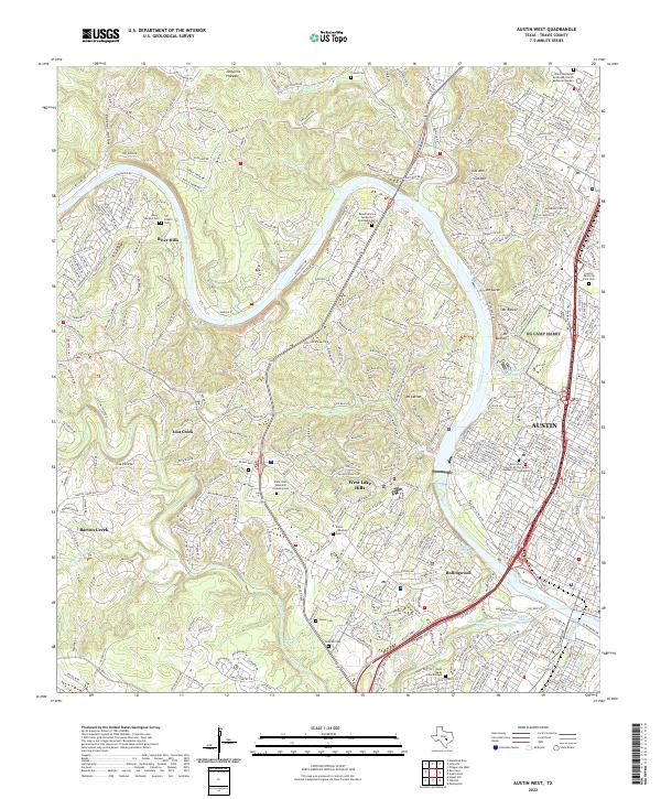
2022 Map of Austin West
USGS Topo · Published 2022About this map
The Colorado River carves a winding path through the limestone hills west of Austin, defining a landscape of deep canyons and prominent peaks. This modern survey illustrates the suburban development of the Jollyville Plateau and the hills overlooking the river, where established communities like West Lake Hills and Rollingwood are mapped in detail. Significant for local historians and genealogists, the map identifies numerous small burial sites often obscured by modern growth, including the Allen-McNeil Cem, Fowler Cem, and the Eanes Marshall Cem.
Find a feature on this map
61 named features on this map. Tap any name to fly to it.
Don’t see what you’re looking for? This feature index may not catch every label — zoom into the map to look around manually.
Map Details
Editions of this 2022 Austin West Map
This is the sole edition of this map. No revisions or reprints were ever made.
Other maps of this area

1896 · Austin
USGS Topo · 1:125,000

1897 · Austin
USGS Topo · 1:125,000

1910 · Austin
USGS Topo · 1:125,000

1930 · Austin-2
USGS Topo · 1:48,000

1932 · Mt. Bonnell
USGS Topo · 1:62,500

1954 · Austin East
USGS Topo · 1:24,000

1954 · Austin West
USGS Topo · 1:24,000

1954 · Austin
USGS Topo · 1:250,000

1955 · Montopolis
USGS Topo · 1:24,000

1955 · Oak Hill
USGS Topo · 1:24,000