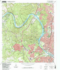
1988 Map of Austin West
USGS Topo · Published 1988About this map
The Colorado River carves a dramatic path through the western edge of Austin in this late-1980s topographic study, defining the landscape between the Jollyville Plateau and the urban center. The river alternates between Lake Austin and Town Lake, flanked by high-elevation landmarks such as Mount Bonnell and Mount Larson. Suburban expansion is evident in the incorporated limits of West Lake Hills and Rollingwood, where the residential street networks contrast with the expansive green spaces of the Wild Basin Wilderness Park and Zilker Park.
Find a feature on this map
69 named features on this map. Tap any name to fly to it.
Don’t see what you’re looking for? This feature index may not catch every label — zoom into the map to look around manually.
Map Details
Editions of this 1988 Austin West Map
This is the sole edition of this map. No revisions or reprints were ever made.
Other maps of this area

1896 · Austin
USGS Topo · 1:125,000

1897 · Austin
USGS Topo · 1:125,000

1910 · Austin
USGS Topo · 1:125,000

1930 · Austin-2
USGS Topo · 1:48,000

1932 · Mt. Bonnell
USGS Topo · 1:62,500

1954 · Austin East
USGS Topo · 1:24,000

1954 · Austin West
USGS Topo · 1:24,000

1954 · Austin
USGS Topo · 1:250,000

1955 · Montopolis
USGS Topo · 1:24,000

1955 · Oak Hill
USGS Topo · 1:24,000