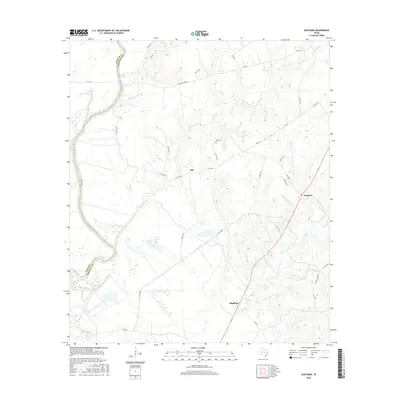
2016 Map of Austonio
USGS Topo · Published 2016About this map
The Trinity River defines the western boundary of this Houston County landscape, where the fertile bottomlands meet the rising timber and ranch land of East Texas. The small community of Austonio serves as a central hub for the surrounding rural area, connected by a network of farm roads like FM 1280 and local routes including Alabama Ferry Rd, which hints at historical river crossings. To the west, the oxbow formations of Coon Lake 1 and Coon Lake 2 indicate the shifting course of the river over time near Pecan Slough.
Find a feature on this map
41 named features on this map. Tap any name to fly to it.
Don’t see what you’re looking for? This feature index may not catch every label — zoom into the map to look around manually.
Map Details
Editions of this 2016 Austonio Map
This is the sole edition of this map. No revisions or reprints were ever made.
Other maps of this area

1953 · Palestine
USGS Topo · 1:250,000

1957 · Palestine
USGS Topo · 1:250,000

1964 · Sand Ridge
USGS Topo · 1:24,000

1964 · Austonio
USGS Topo · 1:24,000

1964 · Porter Springs
USGS Topo · 1:24,000

1964 · Pearsons Chapel
USGS Topo · 1:24,000

1964 · Eunice
USGS Topo · 1:24,000

1964 · Middleton
USGS Topo · 1:24,000
1964 · Weldon
USGS Topo · 1:24,000

1964 · Halls Bluff
USGS Topo · 1:24,000