
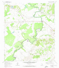
1964 Map of Halls Bluff
USGS Topo · Published 1967About this map
The Trinity River snakes through the center of this landscape, forming the winding border between Houston and Leon counties. The river is characterized by dramatic features such as the Big Bend, Kickapoo Rapids, and a series of prominent high points including Halls Bluff, Brookfield Bluff, and Wiggins Bluff. These bluffs overlook a floodplain dense with oxbow remnants and seasonal water bodies like Horseshoe Lake, Tubb Lake, and Busch Slough.
Find a feature on this map
29 named features on this map. Tap any name to fly to it.
Don’t see what you’re looking for? This feature index may not catch every label — zoom into the map to look around manually.
Map Details
Editions of this 1964 Halls Bluff Map
2 editions found
Other maps of this area

1953 · Palestine
USGS Topo · 1:250,000

1957 · Palestine
USGS Topo · 1:250,000

1964 · Austonio
USGS Topo · 1:24,000

1964 · Porter Springs
USGS Topo · 1:24,000

1964 · Pearsons Chapel
USGS Topo · 1:24,000

1964 · Eunice
USGS Topo · 1:24,000

1964 · Middleton
USGS Topo · 1:24,000

1964 · Lake Leon
USGS Topo · 1:24,000

1964 · Hays Spring
USGS Topo · 1:24,000

1964 · Stanmire Lake
USGS Topo · 1:24,000