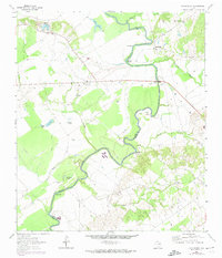
1964 Map of Halls Bluff
USGS Topo · Published 1974About this map
The Trinity River snakes through the borderlands of Leon and Houston counties in this mid-1960s survey, defining a landscape of sharp bluffs and low-lying oxbow lakes. Settlements such as Halls Bluff and Brookfield Bluff occupy the high ground overlooking the river's winding path, while the interior is marked by local landmarks like Malvern and Wheeler Springs. The topography is heavily influenced by the river's dynamic flow, featuring the Kickapoo Rapids and the pronounced Big Bend meander. For genealogists, the map preserves the locations of rural community centers like Union Prairie Ch and local burial grounds including Smith Cem and Porter Springs Cem. Water features dominate the lowlands, with names like Tubb Lake, Horseshoe Lake, and Busch Slough suggesting a seasonal and flood-prone terrain surrounding the main channel.
Find a feature on this map
30 named features on this map. Tap any name to fly to it.
Don’t see what you’re looking for? This feature index may not catch every label — zoom into the map to look around manually.
Map Details
Editions of this 1964 Halls Bluff Map
2 editions found
Other maps of this area

1953 · Palestine
USGS Topo · 1:250,000

1957 · Palestine
USGS Topo · 1:250,000

1964 · Austonio
USGS Topo · 1:24,000

1964 · Porter Springs
USGS Topo · 1:24,000

1964 · Pearsons Chapel
USGS Topo · 1:24,000

1964 · Eunice
USGS Topo · 1:24,000

1964 · Middleton
USGS Topo · 1:24,000

1964 · Halls Bluff
USGS Topo · 1:24,000

1964 · Lake Leon
USGS Topo · 1:24,000

1964 · Hays Spring
USGS Topo · 1:24,000