
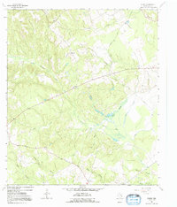
1964 Map of Eunice
USGS Topo · Published 1967About this map
Eunice sits at the center of this rural Leon County landscape, characterized by a complex network of creeks and wooded drainages during the mid-1960s. The settlement pattern is defined by small clusters and family landmarks, such as Hopewell and Haley, connected by winding routes like Nineveh Road. Evidence of local spiritual and community life is found at Victory Ch and the nearby Hopewell Cem, while the natural drainage system of Beaver Dam Creek and Turkey Creek dictates the geography of the surrounding timberland. This period shows a quiet transition in land use, where traditional landmarks like Beaver Dam Cem exist alongside mid-century additions such as a local Landing Strip and a long-distance Pipeline, reflecting the slow modernization of the Texas interior.
Find a feature on this map
22 named features on this map. Tap any name to fly to it.
Don’t see what you’re looking for? This feature index may not catch every label — zoom into the map to look around manually.
Map Details
Editions of this 1964 Eunice Map
2 editions found
Other maps of this area

1953 · Palestine
USGS Topo · 1:250,000

1957 · Palestine
USGS Topo · 1:250,000

1964 · Austonio
USGS Topo · 1:24,000

1964 · Centerville
USGS Topo · 1:24,000

1964 · Flo
USGS Topo · 1:24,000

1964 · Middleton
USGS Topo · 1:24,000

1964 · Halls Bluff
USGS Topo · 1:24,000

1964 · Lake Leon
USGS Topo · 1:24,000

1964 · Leona
USGS Topo · 1:24,000

1964 · Stanmire Lake
USGS Topo · 1:24,000