
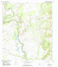
1964 Map of Stanmire Lake
USGS Topo · Published 1967About this map
The Trinity River winds through this 1960s landscape, defining the boundary between Houston and Leon counties. This riverine environment is characterized by a dense network of oxbow lakes and backwaters, including Stanmire Lake, Alligator Lake, and Zeke Lake, many tucked into the prominent Mitchell Bend. The presence of the Navarro Crossing Oil Field indicates the mid-century industrial reach into the rural bottomlands, where numerous oil wells and pipelines cross the terrain near Big Elkhart Creek. Small community centers like Wheeler Springs and Reynard appear alongside scattered country institutions such as Shiloh Church, Greater New Hope Church, and the Sand Flat School. The map also captures several family-named landmarks and water bodies like Taylor Lake and Haley Creek, which offer valuable points of reference for genealogists tracing ancestors in this part of East Texas.
Find a feature on this map
38 named features on this map. Tap any name to fly to it.
Don’t see what you’re looking for? This feature index may not catch every label — zoom into the map to look around manually.
Map Details
Editions of this 1964 Stanmire Lake Map
2 editions found
Other maps of this area

1951 · Elkhart
USGS Topo · 1:62,500

1953 · Palestine
USGS Topo · 1:250,000

1957 · Palestine
USGS Topo · 1:250,000

1964 · Oakwood
USGS Topo · 1:24,000

1964 · Porter Springs
USGS Topo · 1:24,000

1964 · Eunice
USGS Topo · 1:24,000

1964 · Halls Bluff
USGS Topo · 1:24,000

1964 · Lake Leon
USGS Topo · 1:24,000

1964 · Hays Spring
USGS Topo · 1:24,000

1981 · Palestine
USGS Topo · 1:100,000