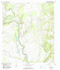
1964 Map of Stanmire Lake
USGS Topo · Published 1991About this map
Navarro Crossing serves as a central landmark in this 1960s landscape, where the Trinity River snakes along the boundary of Houston Co and Leon Co. The river's winding path has created a complex network of oxbows and floodplain water bodies, including Stanmire Lake, Alligator Lake, Wood Lake, and Ben Lake. These features, concentrated near Mitchell Bend, reflect the dynamic hydrological history of the Trinity bottomlands before modern channelization altered many such southern river systems.
Find a feature on this map
41 named features on this map. Tap any name to fly to it.
Don’t see what you’re looking for? This feature index may not catch every label — zoom into the map to look around manually.
Map Details
Editions of this 1964 Stanmire Lake Map
2 editions found
Other maps of this area

1951 · Elkhart
USGS Topo · 1:62,500

1953 · Palestine
USGS Topo · 1:250,000

1957 · Palestine
USGS Topo · 1:250,000

1964 · Oakwood
USGS Topo · 1:24,000

1964 · Porter Springs
USGS Topo · 1:24,000

1964 · Eunice
USGS Topo · 1:24,000

1964 · Halls Bluff
USGS Topo · 1:24,000

1964 · Lake Leon
USGS Topo · 1:24,000

1964 · Hays Spring
USGS Topo · 1:24,000

1964 · Stanmire Lake
USGS Topo · 1:24,000