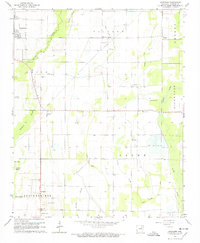
1965 Map of Auvergne
USGS Topo · Published 1966About this map
The Cache River corridor and its surrounding wetlands define the landscape south of Newport during the mid-1960s. This survey illustrates a rural environment shaped by drainage and agriculture, with an extensive network of waterways like Mayberry Slough, Locust Creek, and Skillet Ditch cutting through the terrain. The map is particularly valuable for genealogists, recording numerous local burying grounds including Odd Fellows Cem, Sand Hill Cem, and Leachville Cem.
Find a feature on this map
38 named features on this map. Tap any name to fly to it.
Don’t see what you’re looking for? This feature index may not catch every label — zoom into the map to look around manually.
Map Details
Editions of this 1965 Auvergne Map
2 editions found
Other maps of this area

1935 · Newport
USGS Topo · 1:62,500

1935 · Augusta
USGS Topo · 1:62,500

1935 · Tuckerman
USGS Topo · 1:62,500

1940 · Tilton
USGS Topo · 1:62,500

1953 · Memphis
USGS Topo · 1:250,000

1956 · Memphis
USGS Topo · 1:250,000

1956 · Tilton
USGS Topo · 1:62,500

1957 · Augusta
USGS Topo · 1:62,500

1962 · Jacksonport
USGS Topo · 1:24,000

1962 · Newport
USGS Topo · 1:24,000