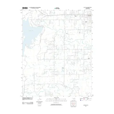
2010 Map of Avant SE
USGS Topo · Published 2010About this map
The expanding town of Skiatook and the eastern reaches of Skiatook Lake anchor this landscape at the edge of the Osage Hills. The terrain is defined by the winding course of Hominy Creek, which feeds into the lake, and a network of smaller waterways including Quapaw Creek, Rock Creek, and Delaware Creek. This period shows a transition from rural homesteads toward suburban residential blocks, particularly around the Skiatook Municipal Airport and along arterial routes like W C Rogers Blvd.
Find a feature on this map
31 named features on this map. Tap any name to fly to it.
Don’t see what you’re looking for? This feature index may not catch every label — zoom into the map to look around manually.
Map Details
Editions of this 2010 Avant SE Map
This is the sole edition of this map. No revisions or reprints were ever made.
Other maps of this area

1901 · Claremore
USGS Topo · 1:125,000

1912 · Hominy
USGS Topo · 1:125,000

1914 · Claremore
USGS Topo · 1:125,000

1915 · Hominy
USGS Topo · 1:125,000

1916 · Claremore
USGS Topo · 1:125,000

1954 · Tulsa
USGS Topo · 1:250,000

1954 · Tulsa
USGS Topo · 1:24,000

1955 · Sperry
USGS Topo · 1:24,000

1955 · Enid
USGS Topo · 1:250,000

1956 · Sand Springs
USGS Topo · 1:24,000