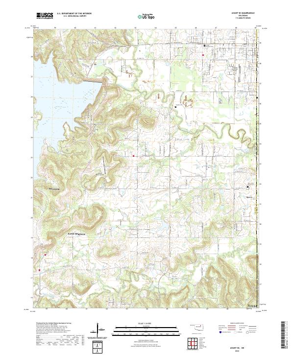
2022 Map of Avant SE
USGS Topo · Published 2022About this map
Hominy Creek and Quapaw Cr weave through a landscape transitioning from the waters of Skiatook Lake to the growing outskirts of Tulsa. This survey of the Osage County and Tulsa County line area illustrates a unique mix of aviation and agriculture, with both the Skiatook Municipal Airport and the private Wilson Ranch Airport serving the region. Local history is anchored by several burial grounds, including the Skiatook Cem and Captain Cem, which provide specific points of interest for genealogists tracking families across the Osage boundary. While Skiatook and Sperry represent the primary population centers, the map also captures the southern drainage patterns of Delaware Creek and Rock Cr, showing the intricate topography that has shaped development between these rural communities and the urban expansion of Sand Springs.
Find a feature on this map
63 named features on this map. Tap any name to fly to it.
Don’t see what you’re looking for? This feature index may not catch every label — zoom into the map to look around manually.
Map Details
Editions of this 2022 Avant SE Map
This is the sole edition of this map. No revisions or reprints were ever made.
Other maps of this area

1901 · Claremore
USGS Topo · 1:125,000

1912 · Hominy
USGS Topo · 1:125,000

1914 · Claremore
USGS Topo · 1:125,000

1915 · Hominy
USGS Topo · 1:125,000

1916 · Claremore
USGS Topo · 1:125,000

1954 · Tulsa
USGS Topo · 1:250,000

1954 · Tulsa
USGS Topo · 1:24,000

1955 · Sperry
USGS Topo · 1:24,000

1955 · Enid
USGS Topo · 1:250,000

1956 · Sand Springs
USGS Topo · 1:24,000