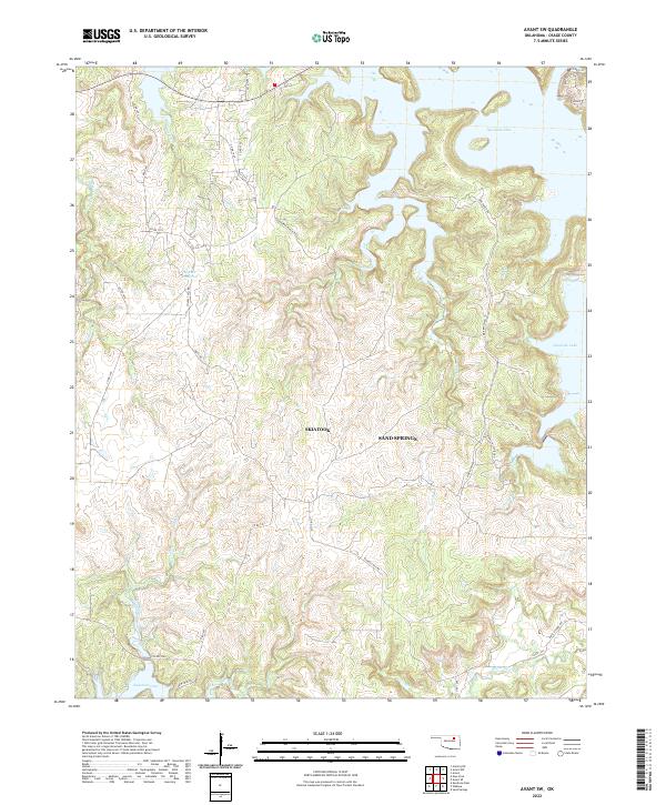
2022 Map of Avant SW
USGS Topo · Published 2022About this map
Skiatook Lake and Keystone Lake dominate the northern and southern reaches of this Osage County landscape, where the boundaries of Skiatook and Sand Springs meet. The terrain is defined by a dense network of drainages including Tall Chief Cr, Eagle Creek, and Delaware Creek, which carve through the land between major ranching and recreation sites. Local history and land use are signaled by thoroughfares such as Zink Ranch Rd and Roundtree Ranch Rd, alongside the youth organization legacy found at Camp Tallchief Rd. In the southern corner, the presence of Rock School Rd hints at the location of early rural community centers. The map provides a contemporary look at this transition zone between deep water reservoirs and the working ranch lands that have shaped the region's character for generations.
Find a feature on this map
41 named features on this map. Tap any name to fly to it.
Don’t see what you’re looking for? This feature index may not catch every label — zoom into the map to look around manually.
Map Details
Editions of this 2022 Avant SW Map
This is the sole edition of this map. No revisions or reprints were ever made.
Other maps of this area

1912 · Hominy
USGS Topo · 1:125,000

1915 · Hominy
USGS Topo · 1:125,000

1915 · Hominy
USGS Topo · 1:62,500

1955 · Enid
USGS Topo · 1:250,000

1956 · Sand Springs
USGS Topo · 1:24,000

1958 · Enid
USGS Topo · 1:250,000

1958 · Keystone Dam
USGS Topo · 1:24,000

1958 · Wekiwa
USGS Topo · 1:24,000
1963 · Avant SE
USGS Topo · 1:24,000
1966 · Avant NW
USGS Topo · 1:24,000