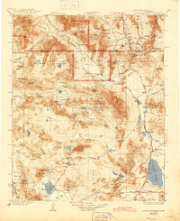
1933 Map of Avawatz Mountains
USGS Topo · Published 1945About this map
The southern reaches of Death Valley and the surrounding high desert terrain define this landscape at a time when industrial extraction and rail travel were still the region's primary lifelines. Along the eastern margins, the Tonopah and Tidewater railroad serves a string of remote outposts including Tecopa, Silver Lake, and Baker. Early 20th-century mining history is evidenced by the presence of the Epsom Salts Works, Ashford Mill, and Confidence Mill, while the path of the Old Spanish Trail cuts through the northeast corner toward Emigrant Pass. Natural water sources like Saratoga Spr and Salt Springs provided critical stops in this arid environment, contrasting with the expansive dry beds of Soda Lake and Bicycle Lake. The map illustrates the early development of the Death Valley National Monument and the sparse network of primitive routes like the Barstow Road.
Find a feature on this map
104 named features on this map. Tap any name to fly to it.
Don’t see what you’re looking for? This feature index may not catch every label — zoom into the map to look around manually.
Map Details
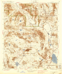
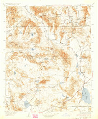
Editions of this 1933 Avawatz Mountains Map
5 editions found


Other maps of this area

1907 · Las Vegas
USGS Topo · 1:250,000

1908 · Furnace Creek
USGS Topo · 1:250,000

1908 · Las Vegas
USGS Topo · 1:250,000

1908 · Ballarat
USGS Topo · 1:250,000

1910 · Furnace Creek
USGS Topo · 1:250,000

1910 · Ivanpah
USGS Topo · 1:250,000

1912 · Ivanpah
USGS Topo · 1:250,000

1913 · Ballarat
USGS Topo · 1:250,000

1915 · Searles Lake
USGS Topo · 1:250,000

1932 · Barstow
USGS Topo · 1:125,000