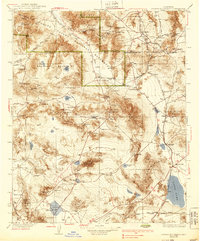
1933 Map of Avawatz Mountains
USGS Topo · Published 1939About this map
The Amargosa Range and Black Mts define this desert landscape, where industrial remnants like the Epsom Salts Works and a Monorail RR hint at the grueling efforts to extract minerals from the basin. The Amargosa River flows through the heart of the region toward Death Valley, supporting scattered outposts such as China Ranch and Tecopa. This map captures a period of early 20th-century expansion before many of these rail-dependent settlements faded.
Find a feature on this map
99 named features on this map. Tap any name to fly to it.
Don’t see what you’re looking for? This feature index may not catch every label — zoom into the map to look around manually.
Map Details
Editions of this 1933 Avawatz Mountains Map
5 editions found

Other maps of this area

1907 · Las Vegas
USGS Topo · 1:250,000

1908 · Furnace Creek
USGS Topo · 1:250,000

1908 · Las Vegas
USGS Topo · 1:250,000

1908 · Ballarat
USGS Topo · 1:250,000

1910 · Furnace Creek
USGS Topo · 1:250,000

1910 · Ivanpah
USGS Topo · 1:250,000

1912 · Ivanpah
USGS Topo · 1:250,000

1913 · Ballarat
USGS Topo · 1:250,000

1915 · Searles Lake
USGS Topo · 1:250,000

1932 · Barstow
USGS Topo · 1:125,000