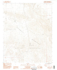
1985 Map of Avawatz Pass
USGS Topo · Published 1985About this map
The Avawatz Mountains dominate this arid landscape within San Bernardino County, a region shaped by high-desert terrain and restricted federal land use. In the mid-1980s, large portions of the area were managed as the Fort Irwin Military Reservation, with the Military Reservation Boundary clearly demarcated across the rugged topography. Water is a scarce and defining resource here, indicated by the presence of Cave Spring and the Denning Spring (Dry), which serve as critical landmarks in an otherwise unforgiving environment. Sparse industrial activity is evidenced by scattered prospects, suggesting the historical reach of mineral exploration into these remote slopes. The map captures a moment when the intersection of strategic military needs and traditional desert resource extraction defined the land's character.
Find a feature on this map
11 named features on this map. Tap any name to fly to it.
Don’t see what you’re looking for? This feature index may not catch every label — zoom into the map to look around manually.
Map Details
Editions of this 1985 Avawatz Pass Map
2 editions found
Other maps of this area

1933 · Avawatz Mountains
USGS Topo · 1:250,000

1947 · Trona
USGS Topo · 1:250,000

1948 · Red Pass Lake
USGS Topo · 1:62,500

1948 · Trona
USGS Topo · 1:250,000

1948 · Leach Lake
USGS Topo · 1:62,500

1948 · Avawatz Pass
USGS Topo · 1:62,500

1948 · Tiefort Mountains
USGS Topo · 1:62,500

1951 · Tiefort Mountains
USGS Topo · 1:62,500

1951 · Avawatz Pass
USGS Topo · 1:62,500

1951 · Red Pass Lake
USGS Topo · 1:62,500