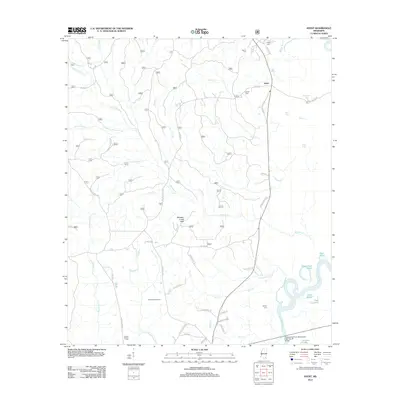
2012 Map of Avent
USGS Topo · Published 2012About this map
The settlement of Avent sits near the upper reaches of the Pascagoula River watershed in this 2012 survey. The landscape is defined by a dense network of watercourses, including the winding Whiskey Creek which drains the Whiskey Creek Hills, and the broader waters of Black Creek. To the southeast, the terrain transitions into river bottomlands featuring oxbow formations and cutoff channels like the Davis-Dead River, Dace Lake, and McClelland Lake.
Find a feature on this map
59 named features on this map. Tap any name to fly to it.
Don’t see what you’re looking for? This feature index may not catch every label — zoom into the map to look around manually.
Map Details
Editions of this 2012 Avent Map
This is the sole edition of this map. No revisions or reprints were ever made.
Other maps of this area

1941 · Lucedale
USGS Topo · 1:62,500

1943 · Lucedale
USGS Topo · 1:62,500

1947 · Beaumont
USGS Topo · 1:62,500

1947 · Benndale
USGS Topo · 1:62,500

1949 · Beaumont
USGS Topo · 1:62,500

1949 · Benndale
USGS Topo · 1:62,500

1953 · Hattiesburg
USGS Topo · 1:250,000

1953 · Mobile
USGS Topo · 1:250,000

1957 · Mobile
USGS Topo · 1:250,000

1958 · Hattiesburg
USGS Topo · 1:250,000