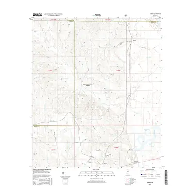
2015 Map of Avent
USGS Topo · Published 2015About this map
Desoto National Forest dominates the landscape of this 2015 survey, covering a complex network of ridges and drainages where Greene, Perry, and George Counties meet. The terrain is defined by the Whiskey Creek Hills and a dense hydrological system including Whiskey Cr, Black Creek, and the winding Pascagoula River in the southeast. Genealogists will find several family-named burial sites such as Pipkin Cem, Fairley Cem, and Nixon-Mizelle Cem, alongside the small settlement of Avent near the northern boundary. The southeastern corner reveals a dynamic riverine environment where the Davis Dead River, Dace Lake, and Otter Pond occupy the lowlands near the Pascagoula River Mississippi Highway 26 Bridge. This modern topographic study shows the persistence of rural road networks like Clarence Fairley Rd and Salem School Rd amidst the protected forest lands.
Find a feature on this map
53 named features on this map. Tap any name to fly to it.
Don’t see what you’re looking for? This feature index may not catch every label — zoom into the map to look around manually.
Map Details
Editions of this 2015 Avent Map
This is the sole edition of this map. No revisions or reprints were ever made.
Other maps of this area

1941 · Lucedale
USGS Topo · 1:62,500

1943 · Lucedale
USGS Topo · 1:62,500

1947 · Beaumont
USGS Topo · 1:62,500

1947 · Benndale
USGS Topo · 1:62,500

1949 · Beaumont
USGS Topo · 1:62,500

1949 · Benndale
USGS Topo · 1:62,500

1953 · Hattiesburg
USGS Topo · 1:250,000

1953 · Mobile
USGS Topo · 1:250,000

1957 · Mobile
USGS Topo · 1:250,000

1958 · Hattiesburg
USGS Topo · 1:250,000