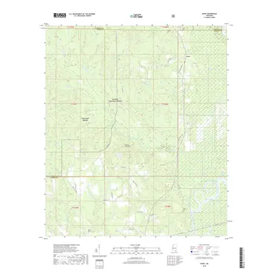
2018 Map of Avent
USGS Topo · Published 2018About this map
De Soto National Forest dominates much of this George County landscape, where the piney woods meet the intricate river bottoms of the southeast. The community of Avent sits near the crossing of Salem Rd and the Black Creek drainage, serving as a landmark in a territory defined by timber and water. This survey illustrates the dense network of small tributaries including Whiskey Cr, Green Cr, and Burnt-Rock Cr, which carve through the Whiskey Creek Hills before reaching the alluvial plains.
Find a feature on this map
52 named features on this map. Tap any name to fly to it.
Don’t see what you’re looking for? This feature index may not catch every label — zoom into the map to look around manually.
Map Details
Editions of this 2018 Avent Map
This is the sole edition of this map. No revisions or reprints were ever made.
Other maps of this area

1941 · Lucedale
USGS Topo · 1:62,500

1943 · Lucedale
USGS Topo · 1:62,500

1947 · Beaumont
USGS Topo · 1:62,500

1947 · Benndale
USGS Topo · 1:62,500

1949 · Beaumont
USGS Topo · 1:62,500

1949 · Benndale
USGS Topo · 1:62,500

1953 · Hattiesburg
USGS Topo · 1:250,000

1953 · Mobile
USGS Topo · 1:250,000

1957 · Mobile
USGS Topo · 1:250,000

1958 · Hattiesburg
USGS Topo · 1:250,000