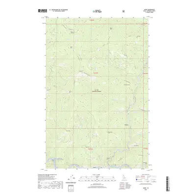
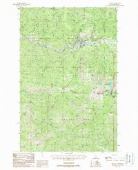
2020 Map of Avery
USGS Topo · Published 2020About this map
The Saint Joe River corridor anchors this modern survey of the Idaho panhandle, where the small settlement of Avery sits at the confluence of Avery Creek. The landscape is dominated by the St. Joe National Forest, a terrain of high ridges and deep gulches carved by numerous tributaries such as Storm Creek and Kyle Creek. This region is managed under the Saint Joe Wild and Scenic River designation, preserving the water system's character as it winds through the Bitterroot mountains. Peaks like Marcus Cook Peak, Mozier Peak, and Arid Peak define the high ground, while historical passage is traced along the Moon Pass Road and the Hammond Kyle Divide. Local infrastructure includes the North Fork Saint Joe River Road, which provides access to remote reaches like Stetson and the trailhead for the Telichpah Creek National Recreation Trail.
Find a feature on this map
54 named features on this map. Tap any name to fly to it.
Don’t see what you’re looking for? This feature index may not catch every label — zoom into the map to look around manually.
Map Details
Editions of this 2020 Avery Map
This is the sole edition of this map. No revisions or reprints were ever made.
Other maps of this area

1914 · Avery
USGS Topo · 1:125,000

1917 · Avery
USGS Topo · 1:125,000

1956 · Saltese
USGS Topo · 1:62,500

1956 · Wallace
USGS Topo · 1:250,000

1957 · Wallace
USGS Topo · 1:62,500

1960 · Wallace
USGS Topo · 1:250,000
1969 · Hoyt Mountain
USGS Topo · 1:24,000
1969 · Three Sisters
USGS Topo · 1:24,000
1969 · Fishhook Creek
USGS Topo · 1:24,000
1988 · Mullan
USGS Topo · 1:24,000