
1957 Map of Wallace
USGS Topo · Published 1959About this map
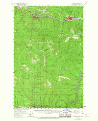
Mining operations and industrial infrastructure define the South Fork Coeur d'Alene River valley in this late-1950s survey. The landscape is punctuated by major excavations such as the Morning Mine and Lucky Friday Mine near Mullan, alongside the Galena Mine further west near Silverton. The heavy industrial character of the region is reflected in the presence of specialized burial grounds like the Miners Union Cemetery.
Find a feature on this map
134 named features on this map. Tap any name to fly to it.
Don’t see what you’re looking for? This feature index may not catch every label — zoom into the map to look around manually.
Map Details
Editions of this 1957 Wallace Map
3 editions found
Other maps of this area

1901 · Coeur D'Alene District
USGS Topo · 1:62,500

1903 · Coeur D'Alene District
USGS Topo · 1:62,500

1906 · Coeur D'Alene District
USGS Topo · 1:62,500

1909 · Cataldo
USGS Topo · 1:125,000

1911 · Cataldo
USGS Topo · 1:125,000

1914 · Avery
USGS Topo · 1:125,000

1917 · Avery
USGS Topo · 1:125,000

1932 · Trout Creek
USGS Topo · 1:125,000

1935 · Trout Creek
USGS Topo · 1:125,000

1936 · Trout Creek
USGS Topo · 1:125,000