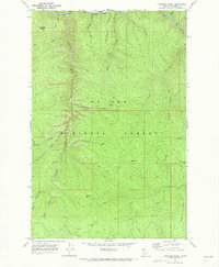
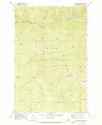
1969 Map of Fishhook Creek
USGS Topo · Published 1973About this map
The St Joe River corridor defines the northern edge of this Idaho mountain landscape, where the tracks of the C M St P & P railroad followed the water's path through the St Joe National Forest. This late 1960s survey documents a terrain shaped by resource extraction and transit, noting an unnamed Mine and a nearby Prospect along the steep slopes of Fishhook Creek. The drainage system is intricate, featuring numerous named tributaries like Theriault Creek, Williams Creek, and Horsecamp Creek that cut through the high ridges. Landmark elevations such as Flemming Point, Jacksons Knob, and Bonehead Hill provide reference points for the area's verticality, while Brebner Flat offers a rare level bench above the creek valleys. A network of jeep trails provides the primary interior access, connecting these remote drainage basins and localized industrial sites like the Gravel Pits in the southern reaches of the quadrangle.
Find a feature on this map
28 named features on this map. Tap any name to fly to it.
Don’t see what you’re looking for? This feature index may not catch every label — zoom into the map to look around manually.
Map Details
Editions of this 1969 Fishhook Creek Map
This is the sole edition of this map. No revisions or reprints were ever made.
Other maps of this area

1914 · Avery
USGS Topo · 1:125,000

1917 · Avery
USGS Topo · 1:125,000

1956 · Saltese
USGS Topo · 1:62,500

1956 · Wallace
USGS Topo · 1:250,000

1957 · Wallace
USGS Topo · 1:62,500

1960 · Wallace
USGS Topo · 1:250,000
1969 · Montana Peak
USGS Topo · 1:24,000
1969 · Monumental Buttes
USGS Topo · 1:24,000
1969 · Hoyt Mountain
USGS Topo · 1:24,000
1969 · Three Sisters
USGS Topo · 1:24,000