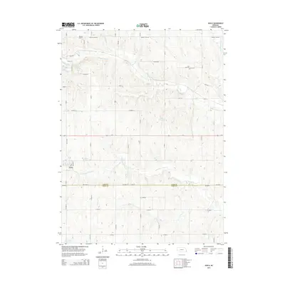
2014 Map of Avoca
USGS Topo · Published 2014About this map
The village of Avoca anchors this 2014 survey of the agricultural landscape along the border of Cass and Otoe counties. Situated at the junction of Ne-13c Spur and O ST, the settlement is surrounded by a network of drainage systems feeding into Weeping Water Cr, including the S Br Weeping Water Cr and N Br Weeping Water Cr. The terrain is marked by essential rural infrastructure and water management features such as Ahrens Reservoir, Bond Reservoir, and the Wilson Cr Reservoir 12-3.
Find a feature on this map
54 named features on this map. Tap any name to fly to it.
Don’t see what you’re looking for? This feature index may not catch every label — zoom into the map to look around manually.
Map Details
Editions of this 2014 Avoca Map
This is the sole edition of this map. No revisions or reprints were ever made.
Other maps of this area

1903 · Weeping Water
USGS Topo · 1:125,000

1907 · Nebraska City
USGS Topo · 1:62,500

1929 · Weeping Water
USGS Topo · 1:125,000

1935 · Nehawka
USGS Topo · 1:48,000

1940 · Nehawka
USGS Topo · 1:62,500

1955 · Nebraska City
USGS Topo · 1:250,000

1955 · Lincoln
USGS Topo · 1:250,000

1956 · Murray
USGS Topo · 1:24,000
1956 · Weeping Water NE
USGS Topo · 1:24,000

1957 · Nebraska City
USGS Topo · 1:250,000