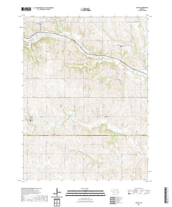
2021 Map of Avoca
USGS Topo · Published 2021About this map
The village of Avoca sits at the southwestern edge of this landscape, nestled near the headwaters of the S Br Weeping Water Cr. This rural territory along the border of Cass and Otoe counties is defined by an intricate network of drainage, including Flood Cr, Jordan Cr, and the main stem of Weeping Water Cr. The agricultural character of the region is evident in the grid-based road system, with family-named landmarks like Browns Airport and the Saint Johns Cem serving as significant points for genealogical research. The map captures the subtle topography of the Nebraska plains, shaped by water management features such as Ahrens Reservoir and Bond Reservoir. This survey provides a clear view of the rural infrastructure at the start of the 2020s, showing how legacy farm roads like Weeping Water Rd and Van Dorn St continue to organize the prairie.
Find a feature on this map
39 named features on this map. Tap any name to fly to it.
Don’t see what you’re looking for? This feature index may not catch every label — zoom into the map to look around manually.
Map Details
Editions of this 2021 Avoca Map
This is the sole edition of this map. No revisions or reprints were ever made.
Other maps of this area

1903 · Weeping Water
USGS Topo · 1:125,000

1907 · Nebraska City
USGS Topo · 1:62,500

1929 · Weeping Water
USGS Topo · 1:125,000

1935 · Nehawka
USGS Topo · 1:48,000

1940 · Nehawka
USGS Topo · 1:62,500

1955 · Nebraska City
USGS Topo · 1:250,000

1955 · Lincoln
USGS Topo · 1:250,000

1956 · Murray
USGS Topo · 1:24,000
1956 · Weeping Water NE
USGS Topo · 1:24,000

1957 · Nebraska City
USGS Topo · 1:250,000