
2020 Map of Avon
USGS Topo · Published 2020About this map
Avon marks the lower southwestern corner of this study, positioned at a remote junction within the expansive Escalante Desert of Iron County. The landscape is defined by the diagonal transit of the Lund Hwy, which cuts across the arid floor, connecting the settlement to the wider region. In the southeast, the seasonal flow of Iron Springs Cr appears alongside several rural loop roads, including the Perkinski Schoppman Loop and the S Nelson Loop. This 2020 survey illustrates the modern grid and road network of a high-desert environment where water sources and transit corridors dictate the placement of human habitation and ranching infrastructure.
Find a feature on this map
8 named features on this map. Tap any name to fly to it.
Don’t see what you’re looking for? This feature index may not catch every label — zoom into the map to look around manually.
Map Details
Editions of this 2020 Avon Map
This is the sole edition of this map. No revisions or reprints were ever made.
Other maps of this area

1885 · St. George
USGS Topo · 1:250,000

1891 · St. George
USGS Topo · 1:250,000

1950 · Antelope Peak
USGS Topo · 1:24,000

1950 · Enoch
USGS Topo · 1:62,500

1950 · The Three Peaks
USGS Topo · 1:24,000

1950 · Avon SE
USGS Topo · 1:24,000

1951 · Avon SE
USGS Topo · 1:24,000
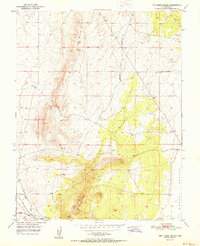
1951 · The Three Peaks
USGS Topo · 1:24,000

1951 · Avon
USGS Topo · 1:24,000

1951 · Avon NW
USGS Topo · 1:24,000