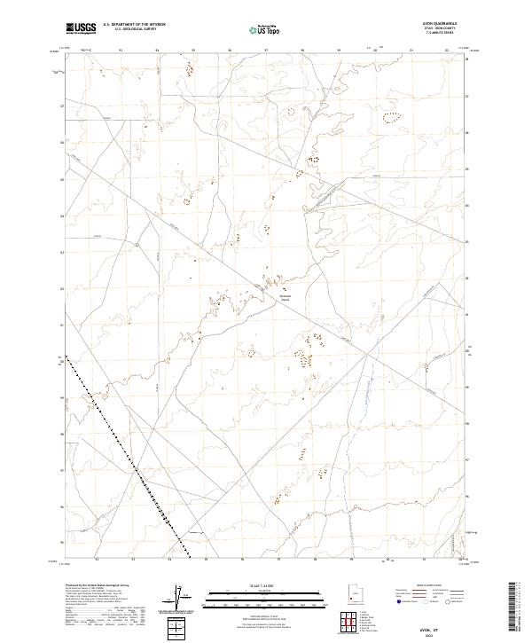
2023 Map of Avon
USGS Topo · Published 2023About this map
The Escalante Desert dominates this arid landscape in Iron County, where the vast desert floor is punctuated by the seasonal course of Iron Springs Creek. This region reflects a grid-based agricultural and ranching infrastructure, defined by a network of local roads including Lund Hwy and various numbered routes like 13300 W. The settlement pattern is largely dispersed, with large-scale land divisions and roads that bear the names of local significance or legacy family ties.
Find a feature on this map
12 named features on this map. Tap any name to fly to it.
Don’t see what you’re looking for? This feature index may not catch every label — zoom into the map to look around manually.
Map Details
Editions of this 2023 Avon Map
This is the sole edition of this map. No revisions or reprints were ever made.
Other maps of this area

1885 · St. George
USGS Topo · 1:250,000

1891 · St. George
USGS Topo · 1:250,000

1950 · Antelope Peak
USGS Topo · 1:24,000

1950 · Enoch
USGS Topo · 1:62,500

1950 · The Three Peaks
USGS Topo · 1:24,000

1950 · Avon SE
USGS Topo · 1:24,000

1951 · Avon SE
USGS Topo · 1:24,000
1951 · The Three Peaks
USGS Topo · 1:24,000

1951 · Avon
USGS Topo · 1:24,000

1951 · Avon NW
USGS Topo · 1:24,000