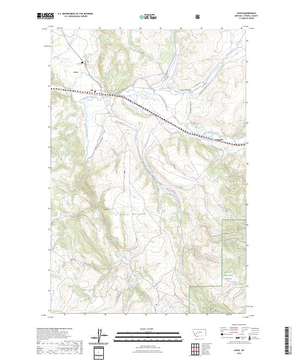
2024 Map of Avon
USGS Topo · Published 2024About this map
The Little Blackfoot River cuts through the center of this landscape, anchoring the settlements of Avon and Elliston. In the north, the Avon Valley transitions into the high elevations of the Boulder Mountains to the south. This mountain range dominates the lower half of the map, where the headwaters of Trout Creek and Spotted Dog Creek emerge from the steep slopes. The eastern edge includes protected land within the Helena National Forest.
Find a feature on this map
27 named features on this map. Tap any name to fly to it.
Don’t see what you’re looking for? This feature index may not catch every label — zoom into the map to look around manually.
Map Details
Editions of this 2024 Avon Map
This is the sole edition of this map. No revisions or reprints were ever made.
Other maps of this area

1889 · Helena
USGS Topo · 1:250,000

1893 · Helena
USGS Topo · 1:250,000

1899 · Boulder
USGS Topo · 1:125,000

1899 · Helena
USGS Topo · 1:250,000

1903 · Helena
USGS Topo · 1:250,000

1947 · Butte
USGS Topo · 1:250,000

1954 · Basin
USGS Topo · 1:62,500

1958 · Butte
USGS Topo · 1:250,000

1958 · Avon
USGS Topo · 1:62,500

1959 · Deer Lodge
USGS Topo · 1:62,500