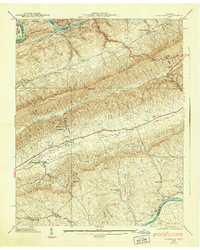
1939 Map of Avondale
USGS Topo · Published 1939About this map
Clinch Mountain forms the dominant northeast-to-southwest backbone of this 1939 survey, separating the rural communities of the Poor Valley from the Richland Valley. The landscape is defined by its deep ridges and gaps, most notably Bean Gap and Notchy Gap, which dictated the path of early Tennessee settlement and transportation. In the south, the Holston River winds past Turley Island and the site of Turley Mill, while the northwestern corner shows the waters of the Norris Reservoir filling the Clinch River valley. This era reveals a network of neighborhood centers like Avondale and Thorn Hill anchored by local institutions, including the Beech Grove Sch, Dotson Camp Ground Ch, and the Shields Cem. The map provides an intricate look at the local geography just before modern development altered these traditional East Tennessee farm and river communities.
Find a feature on this map
61 named features on this map. Tap any name to fly to it.
Don’t see what you’re looking for? This feature index may not catch every label — zoom into the map to look around manually.
Map Details
Editions of this 1939 Avondale Map
2 editions found
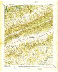
Other maps of this area

1883 · Morristown
USGS Topo · 1:125,000

1893 · Morristown
USGS Topo · 1:125,000

1895 · Morristown
USGS Topo · 1:125,000

1897 · Maynardville
USGS Topo · 1:125,000

1900 · Maynardville
USGS Topo · 1:125,000

1935 · Tate Springs
USGS Topo · 1:48,000

1935 · Straw Plains
USGS Topo · 1:48,000

1935 · Joppa
USGS Topo · 1:24,000

1935 · Howard Quarter
USGS Topo · 1:24,000

1935 · Swan Island
USGS Topo · 1:24,000