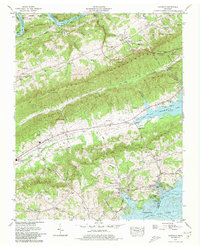
1979 Map of Avondale
USGS Topo · Published 1980About this map
Clinch Mountain and Copper Ridge dominate the landscape in this portion of Grainger and Claiborne counties, creating a series of parallel valleys that have historically dictated the region's settlement patterns. The topography is defined by the massive reservoirs of Norris Lake to the northwest and Cherokee Lake to the southeast, both products of the Tennessee Valley Authority's mid-century hydroelectric and flood control projects. Between these waters, small farming communities and family-named landmarks endure along the narrow corridors of Richland Valley and Poor Valley.
Find a feature on this map
81 named features on this map. Tap any name to fly to it.
Don’t see what you’re looking for? This feature index may not catch every label — zoom into the map to look around manually.
Map Details
Editions of this 1979 Avondale Map
2 editions found
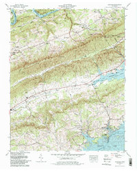
Other maps of this area

1883 · Morristown
USGS Topo · 1:125,000

1893 · Morristown
USGS Topo · 1:125,000

1895 · Morristown
USGS Topo · 1:125,000

1897 · Maynardville
USGS Topo · 1:125,000

1900 · Maynardville
USGS Topo · 1:125,000

1935 · Tate Springs
USGS Topo · 1:48,000

1935 · Straw Plains
USGS Topo · 1:48,000

1935 · Joppa
USGS Topo · 1:24,000

1935 · Howard Quarter
USGS Topo · 1:24,000

1935 · Swan Island
USGS Topo · 1:24,000