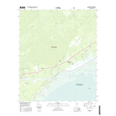
2017 Map of Awendaw
USGS Topo · Published 2017About this map
Francis Marion National Forest dominates the northern reaches of this coastal landscape, where the dense hydrology of Wambaw Swamp and Steed Creek Swamp gives way to the tidal marshes of the South Carolina coast. The settlement of Awendaw sits near the winding course of Awendaw Creek, a waterway that transitions from secluded forest streams into the broad Bulls Bay. Modern recreational trails, including the Awendaw Passage/Palmetto Trl, trace the edges of these wetlands, offering a detailed look at how the terrestrial forest meets the aquatic environment of the Cape Romain National Wildlife Refuge.
Find a feature on this map
31 named features on this map. Tap any name to fly to it.
Don’t see what you’re looking for? This feature index may not catch every label — zoom into the map to look around manually.
Map Details
Editions of this 2017 Awendaw Map
This is the sole edition of this map. No revisions or reprints were ever made.
Other maps of this area

1919 · Bulls Island
USGS Topo · 1:21,120

1919 · Sewee Bay
USGS Topo · 1:21,120

1942 · Mc Clellanville
USGS Topo · 1:24,000

1942 · Honey Hill
USGS Topo · 1:24,000

1943 · Sewee Bay
USGS Topo · 1:24,000

1943 · Bulls Island
USGS Topo · 1:24,000

1943 · Shulerville
USGS Topo · 1:24,000

1943 · Santee
USGS Topo · 1:24,000

1943 · Awendaw
USGS Topo · 1:24,000

1943 · Ocean Bay
USGS Topo · 1:24,000