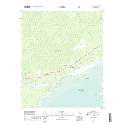
2020 Map of Awendaw
USGS Topo · Published 2020About this map
The Francis Marion National Forest dominates the northern half of this coastal landscape, where the dense timber of the Lowcountry meets the salt marshes of the Atlantic. The transition from the shaded depths of Wambaw Swamp and Little Wambaw Swamp to the open waters of Bulls Bay defines the local geography. Human activity is concentrated along the historic corridors of the Old Georgetown Rd and the more modern Highway 17, which connects the small settlements of Pineland and Awendaw. Coastal commerce and recreation are represented by the Intracoastal Waterway and the nearby Buck Hall area, providing access to the rich estuarine environment. Large landholdings like Laurel Hill Plantation and infrastructure such as the Laurel Hill Farms Airport provide specific points of interest for local historians studying the evolution of land use and transportation in Charleston County.
Find a feature on this map
34 named features on this map. Tap any name to fly to it.
Don’t see what you’re looking for? This feature index may not catch every label — zoom into the map to look around manually.
Map Details
Editions of this 2020 Awendaw Map
This is the sole edition of this map. No revisions or reprints were ever made.
Other maps of this area

1919 · Bulls Island
USGS Topo · 1:21,120

1919 · Sewee Bay
USGS Topo · 1:21,120

1942 · Mc Clellanville
USGS Topo · 1:24,000

1942 · Honey Hill
USGS Topo · 1:24,000

1943 · Sewee Bay
USGS Topo · 1:24,000

1943 · Bulls Island
USGS Topo · 1:24,000

1943 · Shulerville
USGS Topo · 1:24,000

1943 · Santee
USGS Topo · 1:24,000

1943 · Awendaw
USGS Topo · 1:24,000

1943 · Ocean Bay
USGS Topo · 1:24,000