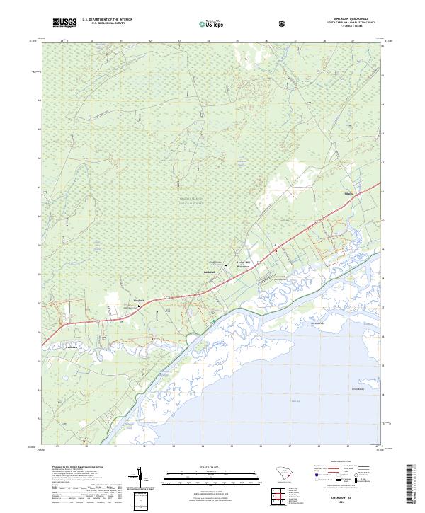
2024 Map of Awendaw
USGS Topo · Published 2024About this map
The Francis Marion National Forest dominates this coastal landscape, where the dense wetlands of Wambaw Swamp and the Little Wambaw Swamp Wilderness transition into the brackish reaches of Bulls Bay. Local heritage is centered around the small settlements of Pineland, Buck Hall, and Tibwin, with the Saint James AME Church and Saint James AME Church Cem serving as significant genealogical landmarks. The mapping detail shows the spatial relationship between the Laurel Hill Plantation and the modern Laurel Hill Farms Airport, illustrating a continuity of land use from agrarian roots to contemporary infrastructure. Along the shoreline, the Intracoastal Waterway cuts a distinct path through the Cape Romain National Wildlife Refuge, marking the boundary between the mainland forest and the protected barrier islands of the Cape Romain Wilderness.
Find a feature on this map
44 named features on this map. Tap any name to fly to it.
Don’t see what you’re looking for? This feature index may not catch every label — zoom into the map to look around manually.
Map Details
Editions of this 2024 Awendaw Map
This is the sole edition of this map. No revisions or reprints were ever made.
Other maps of this area

1919 · Bulls Island
USGS Topo · 1:21,120

1919 · Sewee Bay
USGS Topo · 1:21,120

1942 · Mc Clellanville
USGS Topo · 1:24,000

1942 · Honey Hill
USGS Topo · 1:24,000

1943 · Sewee Bay
USGS Topo · 1:24,000

1943 · Bulls Island
USGS Topo · 1:24,000

1943 · Shulerville
USGS Topo · 1:24,000

1943 · Santee
USGS Topo · 1:24,000

1943 · Awendaw
USGS Topo · 1:24,000

1943 · Ocean Bay
USGS Topo · 1:24,000