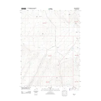
2013 Map of Axial
USGS Topo · Published 2013About this map
Axial Basin serves as the central geographic anchor for this part of Moffat County, where the settlement of Axial and several established homesteads define the high-desert ranching landscape. The map details a network of water rights and drainage systems essential for agriculture in this arid region, including Wilson Reservoir and the winding course of Milk Cr. Prominent elevations like Duffy Mountain, Iles Mountain, and Mount Streeter overlook the valley floor, providing a clear picture of the local topography. Established properties such as the Gossard Ranch, Wilson Ranch, and Circle Bar Ranch are clearly identified, offering valuable data for those researching family land holdings or the development of western Colorado stock raising in the early 21st century. Infrastructure is primarily comprised of county roads and Co-13, which follow the natural contours of the various gulches and creek beds.
Find a feature on this map
31 named features on this map. Tap any name to fly to it.
Don’t see what you’re looking for? This feature index may not catch every label — zoom into the map to look around manually.
Map Details
Editions of this 2013 Axial Map
This is the sole edition of this map. No revisions or reprints were ever made.
Other maps of this area

1910 · Danforth Hills
USGS Topo · 1:125,000

1912 · Meeker
USGS Topo · 1:62,500

1912 · Axial
USGS Topo · 1:62,500

1914 · Meeker
USGS Topo · 1:62,500

1914 · Axial
USGS Topo · 1:62,500

1915 · Monument Butte
USGS Topo · 1:62,500

1954 · Craig
USGS Topo · 1:250,000

1957 · Craig
USGS Topo · 1:250,000

1958 · Craig
USGS Topo · 1:250,000

1960 · Craig
USGS Topo · 1:250,000