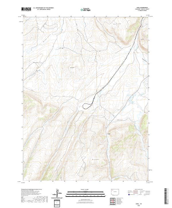
2022 Map of Axial
USGS Topo · Published 2022About this map
Axial Basin serves as the focal point of this Moffat County landscape, where the small settlement of Axial stands at the junction of Moffat Co Rd 180 and Co RD 17. The terrain is defined by a complex drainage system that feeds the high-altitude valley, including the Milk Cr and Wilson Cr watersheds. Higher elevations are marked by distinctive landmarks such as Duffy Mtn and Mt Streeter, which rise above the surrounding gulches. This area has long been a remote corner of Colorado, shaped by ranching and resource extraction, with the Wilson Reservoir and various forks of Jubb Cr indicating the critical importance of water management in this arid environment.
Find a feature on this map
28 named features on this map. Tap any name to fly to it.
Don’t see what you’re looking for? This feature index may not catch every label — zoom into the map to look around manually.
Map Details
Editions of this 2022 Axial Map
This is the sole edition of this map. No revisions or reprints were ever made.
Other maps of this area

1910 · Danforth Hills
USGS Topo · 1:125,000

1912 · Meeker
USGS Topo · 1:62,500

1912 · Axial
USGS Topo · 1:62,500

1914 · Meeker
USGS Topo · 1:62,500

1914 · Axial
USGS Topo · 1:62,500

1915 · Monument Butte
USGS Topo · 1:62,500

1954 · Craig
USGS Topo · 1:250,000

1957 · Craig
USGS Topo · 1:250,000

1958 · Craig
USGS Topo · 1:250,000

1960 · Craig
USGS Topo · 1:250,000