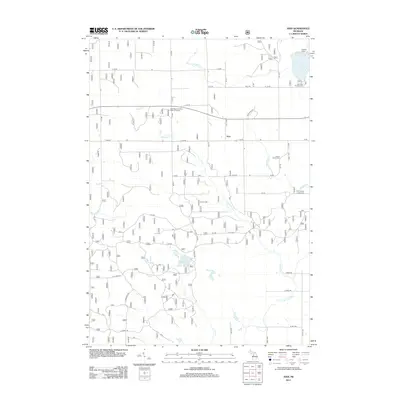
2012 Map of Axin
USGS Topo · Published 2012About this map
The small settlement of Axin sits at a central crossroads in this northern Michigan landscape, characterized by a complex network of forest roads and glacial waterways. To the northeast, the shoreline of Lake Mitchell is home to the Hemlock Campground, while the interior features numerous smaller bodies of water like Lake Olga and the marshy edges of Hay Lake. Genealogists will find interest in the documented burial sites of early residents, including the Larson Family Cem and the Irwin Family Center Cem located east of the main road corridor. The southern portion of the area is defined by the headwaters and drainage of the N Br Pine River and its various tributaries such as Fairchild Cr and Spalding Cr, which wind through the township. Public land management is evident through the designated Lake Olga Auto Tour Point of Interest and an extensive grid of Forest Service routes.
Find a feature on this map
48 named features on this map. Tap any name to fly to it.
Don’t see what you’re looking for? This feature index may not catch every label — zoom into the map to look around manually.
Map Details
Editions of this 2012 Axin Map
This is the sole edition of this map. No revisions or reprints were ever made.
Other maps of this area

1933 · Luther SE
USGS Topo · 1:31,680

1933 · Luther SW
USGS Topo · 1:31,680

1933 · Luther NW
USGS Topo · 1:31,680

1954 · Traverse City
USGS Topo · 1:250,000

1956 · Mesick
USGS Topo · 1:62,500

1956 · Cadillac North
USGS Topo · 1:62,500

1957 · Cadillac South
USGS Topo · 1:62,500

1957 · Luther
USGS Topo · 1:62,500

1958 · Traverse City
USGS Topo · 1:250,000

1983 · Cadillac
USGS Topo · 1:100,000