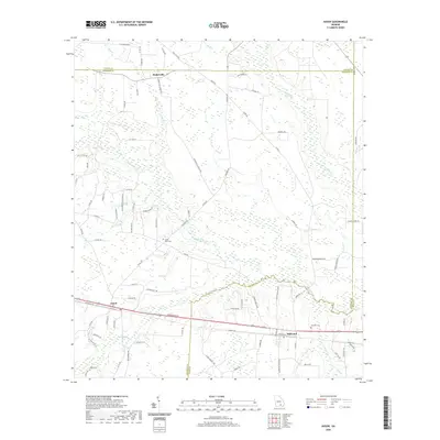
2020 Map of Axson
USGS Topo · Published 2020About this map
Satilla River and the Seventeen Mile River dominate this South Georgia landscape at the junction of Coffee, Atkinson, and Ware counties. Small agricultural settlements and crossroads define the human footprint, with Axson and Millwood serving as primary anchors along the southern corridor. The map reveals a high concentration of named water bodies and drainage systems typical of the region, including Red Bluff Cr, Perch Cr, and Smut Br, which wind through the low-lying terrain. Genealogy researchers will find several localized burial sites such as Little Utah Cem and Bennett Cem, providing specific geographic anchors for family history. The network of rural routes, from Paul Cady Rd to Stokesville Church Rd, illustrates the enduring rural infrastructure connecting isolated farmsteads and the community of Stokesville to the larger river basin.
Find a feature on this map
88 named features on this map. Tap any name to fly to it.
Don’t see what you’re looking for? This feature index may not catch every label — zoom into the map to look around manually.
Map Details
Editions of this 2020 Axson Map
This is the sole edition of this map. No revisions or reprints were ever made.
Other maps of this area

1953 · Waycross
USGS Topo · 1:250,000

1958 · Waycross
USGS Topo · 1:250,000

1967 · Pine Valley
USGS Topo · 1:24,000

1968 · Cogdell
USGS Topo · 1:24,000

1971 · Douglas South
USGS Topo · 1:24,000

1971 · Wilsonville
USGS Topo · 1:24,000

1971 · Beach
USGS Topo · 1:24,000

1971 · Axson
USGS Topo · 1:24,000

1971 · Pearson
USGS Topo · 1:24,000

1971 · Talmo
USGS Topo · 1:24,000