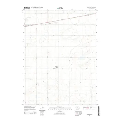
2014 Map of Axtell East
USGS Topo · Published 2014About this map
Keene and the surrounding agricultural landscape of Kearney County define this central Nebraska study. The grid-like organization of the rural township is punctuated by historical burial grounds, notably Keene Cem and Garden Plain Cem, which provide specific points of interest for genealogists tracing families in this prairie region. Modern transportation corridors like Us-34 and Ne-44 facilitate travel between the larger hubs of Axtell and Minden. The map illustrates a highly structured system of section roads, including Footstrom Rd and Kaapa Ln, reflecting a landscape dedicated to large-scale farming. This 2014 edition provides a clear record of land use and small-town infrastructure in the early 21st century.
Find a feature on this map
28 named features on this map. Tap any name to fly to it.
Don’t see what you’re looking for? This feature index may not catch every label — zoom into the map to look around manually.
Map Details
Editions of this 2014 Axtell East Map
This is the sole edition of this map. No revisions or reprints were ever made.
Other maps of this area

1894 · Kearney
USGS Topo · 1:62,500

1894 · Minden
USGS Topo · 1:62,500

1896 · Holdrege
USGS Topo · 1:125,000

1896 · Kearney
USGS Topo · 1:125,000

1896 · Wood River
USGS Topo · 1:125,000

1897 · Red Cloud
USGS Topo · 1:125,000

1955 · Grand Island
USGS Topo · 1:250,000

1957 · Grand Island
USGS Topo · 1:250,000

1958 · Grand Island
USGS Topo · 1:250,000

1969 · Upland
USGS Topo · 1:24,000