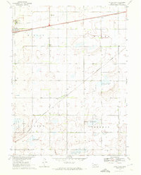
1970 Map of Axtell East
USGS Topo · Published 1972About this map
The agrarian landscape of Kearney County is defined here by the path of the Burlington Northern railroad, which links the settlements of Axtell and Motala across the northern edge of the map. This 1970 survey reveals a community anchored by institutional landmarks such as the Bethpage Mission and several rural burial grounds including Keene Cem and Garden Plain Cem. A significant portion of the southern and eastern terrain is dedicated to the National Wildlife Management Area, showing a transition from the structured grid of sections like Mirage and Oneida to protected natural spaces. The presence of the Radio Tower (KHOL-TV) stands as a modern vertical landmark amidst the horizontal expanse of Nebraska prairie, while the small cluster at Keene serves as a secondary focal point for the surrounding farmsteads.
Find a feature on this map
17 named features on this map. Tap any name to fly to it.
Don’t see what you’re looking for? This feature index may not catch every label — zoom into the map to look around manually.
Map Details
Editions of this 1970 Axtell East Map
This is the sole edition of this map. No revisions or reprints were ever made.
Other maps of this area

1894 · Kearney
USGS Topo · 1:62,500

1894 · Minden
USGS Topo · 1:62,500

1896 · Holdrege
USGS Topo · 1:125,000

1896 · Kearney
USGS Topo · 1:125,000

1896 · Wood River
USGS Topo · 1:125,000

1897 · Red Cloud
USGS Topo · 1:125,000

1955 · Grand Island
USGS Topo · 1:250,000

1957 · Grand Island
USGS Topo · 1:250,000

1958 · Grand Island
USGS Topo · 1:250,000

1969 · Upland
USGS Topo · 1:24,000