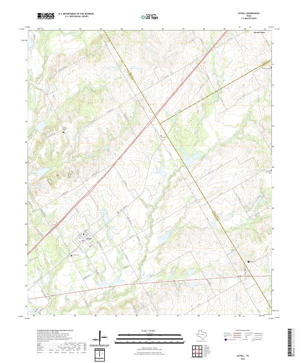
2022 Map of Axtell
USGS Topo · Published 2022About this map
The settlement of Axtell anchors the southwestern portion of this landscape, situated along a dense network of local roads and family-named routes such as Homer Young Ln and S Vicha Rd. This rural expanse in Central Texas is defined by the headwaters and tributaries of several prominent waterways, including Tehuacana Cr, Williams Cr, and Cottonwood Cr. The land use is characterized by numerous small impoundments like Cottonbell Lake and Green Briar Lake, which dot the drainage basins between rolling hills. Genealogists will find a significant concentration of burial sites across the quadrangle, ranging from the Mount Calm Cem near the town of Mount Calm in the northeast to smaller, more isolated plots like TK Cem and Olive Branch Cem. The map clearly delineates the tri-county intersection where the borders of McLennan, Hill, and Limestone counties converge.
Find a feature on this map
91 named features on this map. Tap any name to fly to it.
Don’t see what you’re looking for? This feature index may not catch every label — zoom into the map to look around manually.
Map Details
Editions of this 2022 Axtell Map
This is the sole edition of this map. No revisions or reprints were ever made.
Other maps of this area

1892 · Waco
USGS Topo · 1:125,000

1920 · Waco
USGS Topo · 1:125,000

1920 · Mart
USGS Topo · 1:62,500

1931 · Elm Mott
USGS Topo · 1:62,500

1954 · Waco
USGS Topo · 1:250,000

1955 · Waco
USGS Topo · 1:250,000

1956 · Hubbard
USGS Topo · 1:24,000

1956 · Penelope
USGS Topo · 1:24,000

1956 · Axtell
USGS Topo · 1:24,000

1956 · West
USGS Topo · 1:24,000