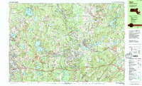
1988 Map of Ayer
USGS Topo · Published 1988About this map
Fort Devens Military Reservation dominates the central landscape of this late 1980s survey, illustrating the significant military footprint in the region during the twilight of the Cold War. The Nashua River and Squannacook River wind through the terrain, flanked by protected lands like the Oxbow National Wildlife Refuge and the Ayer State Game Area. The map reveals a transition from the industrial and transport hubs of Ayer and Leominster to the academic and religious enclaves of Groton Sch and the historic Shaker Village.
Find a feature on this map
104 named features on this map. Tap any name to fly to it.
Don’t see what you’re looking for? This feature index may not catch every label — zoom into the map to look around manually.
Map Details
Editions of this 1988 Ayer Map
2 editions found
Other maps of this area

1885 · Worcester
USGS Topo · 1:62,500

1886 · Worcester
USGS Topo · 1:62,500

1886 · Lowell
USGS Topo · 1:62,500

1886 · Framingham
USGS Topo · 1:62,500

1887 · Marlboro
USGS Topo · 1:62,500

1887 · Fitchburg
USGS Topo · 1:62,500

1889 · Marlboro
USGS Topo · 1:62,500

1889 · Fitchburg
USGS Topo · 1:62,500

1889 · Framingham
USGS Topo · 1:62,500

1892 · Worcester
USGS Topo · 1:62,500