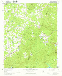
1964 Map of Ayersville
USGS Topo · Published 1979About this map
The boundary between Habersham Co and Stephens Co bisects this mid-century survey, where the Southern Railway winds through the foothills toward Mount Airy. The settlement of Ayersville sits centered near the Chattahoochee National Forest, supported by a network of rural institutions like Mt Pleasant Ch and the Hazel Grove Sch. To the southeast, the prominent profile of Currahee Mtn overlooks the landscape, marked by a Radio Tower Lookout Tower Radio Facility.
Find a feature on this map
82 named features on this map. Tap any name to fly to it.
Don’t see what you’re looking for? This feature index may not catch every label — zoom into the map to look around manually.
Map Details
Editions of this 1964 Ayersville Map
3 editions found
Other maps of this area

1886 · Dahlonega
USGS Topo · 1:125,000

1886 · Walhalla
USGS Topo · 1:125,000

1891 · Gainesville
USGS Topo · 1:125,000

1891 · Carnesville
USGS Topo · 1:125,000

1892 · Dahlonega
USGS Topo · 1:125,000

1892 · Walhalla
USGS Topo · 1:125,000

1896 · Walhalla
USGS Topo · 1:125,000

1896 · Dahlonega
USGS Topo · 1:125,000

1903 · Dahlonega
USGS Topo · 1:125,000

1953 · Tallulah Falls
USGS Topo · 1:24,000