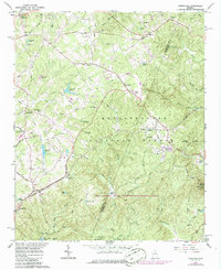
1964 Map of Ayersville
USGS Topo · Published 1986About this map
Ayersville and Mount Airy anchor this map of north Georgia, where the foothills are carved by the Middle Fork Broad River and Hazel Creek. The landscape is a transition between small rural communities and the protected woods of the Chattahoochee National Forest. Evidence of local mountain life appears in the many small congregations like Antioch Ch, Chopped Oak Ch, and Mt Bethel Ch, alongside the Hazel Grove School. The Southern Railway tracks cut across the terrain, serving the settlements that grew along its path. Strategic high points are well-defined, notably Currahee Mountain, which is topped by a lookout tower and radio facility. To the south, the Lake Russell State Wildlife Management Area encompasses landmarks like Camp Robert Toombs and Nancy Town Lake, reflecting the region's managed wilderness character.
Find a feature on this map
81 named features on this map. Tap any name to fly to it.
Don’t see what you’re looking for? This feature index may not catch every label — zoom into the map to look around manually.
Map Details
Editions of this 1964 Ayersville Map
3 editions found
Other maps of this area

1886 · Dahlonega
USGS Topo · 1:125,000

1886 · Walhalla
USGS Topo · 1:125,000

1891 · Gainesville
USGS Topo · 1:125,000

1891 · Carnesville
USGS Topo · 1:125,000

1892 · Dahlonega
USGS Topo · 1:125,000

1892 · Walhalla
USGS Topo · 1:125,000

1896 · Walhalla
USGS Topo · 1:125,000

1896 · Dahlonega
USGS Topo · 1:125,000

1903 · Dahlonega
USGS Topo · 1:125,000

1953 · Tallulah Falls
USGS Topo · 1:24,000