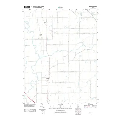
2010 Map of Azalia
USGS Topo · Published 2010About this map
Azalia and Reddington center this 2010 survey of the Indiana countryside, where the winding East Fork White River dictates the western geography. The landscape is defined by a dense network of tributaries including Sand Creek, Mutton Creek, and the swampy lowlands of Thompson Slough. This modern topographical study captures a rural agricultural pattern that has persisted for generations, anchored by local institutions like the Azalia Post Office.
Find a feature on this map
63 named features on this map. Tap any name to fly to it.
Don’t see what you’re looking for? This feature index may not catch every label — zoom into the map to look around manually.
Map Details
Editions of this 2010 Azalia Map
This is the sole edition of this map. No revisions or reprints were ever made.
Other maps of this area

1942 · Columbus
USGS Topo · 1:125,000

1953 · Cincinnati
USGS Topo · 1:250,000

1956 · Louisville
USGS Topo · 1:250,000

1957 · Cincinnati
USGS Topo · 1:250,000

1957 · Jonesville
USGS Topo · 1:24,000

1957 · Azalia
USGS Topo · 1:24,000

1957 · North Vernon
USGS Topo · 1:24,000
1958 · Columbus
USGS Topo · 1:24,000

1958 · Grammer
USGS Topo · 1:24,000
1958 · Elizabethtown
USGS Topo · 1:24,000