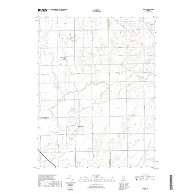
2019 Map of Azalia
USGS Topo · Published 2019About this map
The East Fork White River winds along the western edge of this landscape, carving a wide valley that historically dictated the placement of early settlements and road networks. To the east, the small community of Azalia serves as a focal point near the Azalia Methodist Cem, while Reddington sits further south along the modern thoroughfare of N Co Rd 925 E. The map reveals a highly structured agricultural grid, yet this order is frequently interrupted by the meandering courses of Sand Creek, Sand Br, and Little Sand Creek.
Find a feature on this map
59 named features on this map. Tap any name to fly to it.
Don’t see what you’re looking for? This feature index may not catch every label — zoom into the map to look around manually.
Map Details
Editions of this 2019 Azalia Map
This is the sole edition of this map. No revisions or reprints were ever made.
Other maps of this area

1942 · Columbus
USGS Topo · 1:125,000

1953 · Cincinnati
USGS Topo · 1:250,000

1956 · Louisville
USGS Topo · 1:250,000

1957 · Cincinnati
USGS Topo · 1:250,000

1957 · Jonesville
USGS Topo · 1:24,000

1957 · Azalia
USGS Topo · 1:24,000

1957 · North Vernon
USGS Topo · 1:24,000
1958 · Columbus
USGS Topo · 1:24,000

1958 · Grammer
USGS Topo · 1:24,000
1958 · Elizabethtown
USGS Topo · 1:24,000