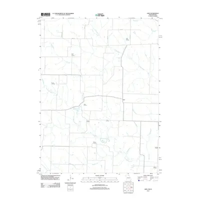
2012 Map of Azen
USGS Topo · Published 2012About this map
The settlement of Azen anchors this rural landscape along the Missouri-Iowa border, where a complex network of waterways defines the terrain. The drainage of the Little Fox River and the North Wyaconda River creates a system of winding creek beds and branches, including Valley Branch, Cook Creek, and Morgan Branch. This 2012 survey illustrates a traditional Midwestern agrarian layout, with a rectilinear road grid—featuring local routes like Deer Ave and 300th St—overlaid upon the natural meandering paths of the river valleys.
Find a feature on this map
27 named features on this map. Tap any name to fly to it.
Don’t see what you’re looking for? This feature index may not catch every label — zoom into the map to look around manually.
Map Details
Editions of this 2012 Azen Map
This is the sole edition of this map. No revisions or reprints were ever made.
Other maps of this area

1903 · Kahoka
USGS Topo · 1:125,000

1903 · Edina
USGS Topo · 1:125,000

1951 · Wyaconda
USGS Topo · 1:24,000

1954 · Centerville
USGS Topo · 1:250,000

1957 · Centerville
USGS Topo · 1:250,000

1958 · Centerville
USGS Topo · 1:250,000

1958 · Burlington
USGS Topo · 1:250,000

1961 · Burlington
USGS Topo · 1:250,000

1963 · Burlington
USGS Topo · 1:250,000

1965 · Memphis
USGS Topo · 1:24,000