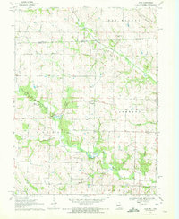
1970 Map of Azen
USGS Topo · Published 1972About this map
The Iowa Missouri state line bisects this quiet rural landscape, where the northern reaches of Scotland County meet the southern edge of Van Buren County. In the early 1970s, this region remained dominated by agricultural patterns and the winding courses of the Fox River and North Wyaconda River. The small settlement of Azen serves as a central landmark amidst a grid of section lines and township boundaries, including Johnson and Thomson.
Find a feature on this map
30 named features on this map. Tap any name to fly to it.
Don’t see what you’re looking for? This feature index may not catch every label — zoom into the map to look around manually.
Map Details
Editions of this 1970 Azen Map
This is the sole edition of this map. No revisions or reprints were ever made.
Other maps of this area

1903 · Kahoka
USGS Topo · 1:125,000

1903 · Edina
USGS Topo · 1:125,000

1951 · Wyaconda
USGS Topo · 1:24,000

1954 · Centerville
USGS Topo · 1:250,000

1957 · Centerville
USGS Topo · 1:250,000

1958 · Centerville
USGS Topo · 1:250,000

1958 · Burlington
USGS Topo · 1:250,000

1961 · Burlington
USGS Topo · 1:250,000

1963 · Burlington
USGS Topo · 1:250,000

1965 · Memphis
USGS Topo · 1:24,000