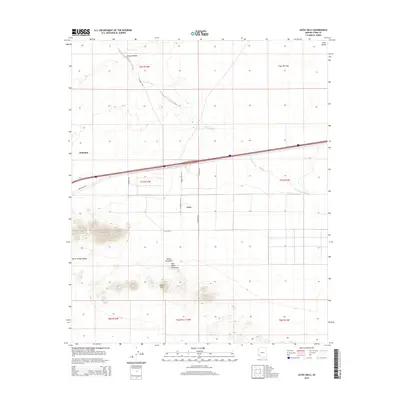
2014 Map of Aztec Hills
USGS Topo · Published 2014About this map
Aztec and Dateland anchor this desert corridor in Yuma County, positioned along the vital transportation artery of the Interstate 8 and its accompanying Frontage Rd. The landscape is defined by the stark transition from the level floor of the San Cristobal Valley to the prominent rising elevations of the Aztec Hills and the distinct peaks of White Mountain and Half White Mountain. Drainage patterns are clearly etched across the arid terrain, most notably by the winding courses of Tenmile Wash and Canyon Diablo as they navigate the basin floor. A precise grid of section lines and local roads like N Avenue 70 E and E Co 2nd St reveals the late 20th-century land management and rural infrastructure that supports these small desert communities.
Find a feature on this map
24 named features on this map. Tap any name to fly to it.
Don’t see what you’re looking for? This feature index may not catch every label — zoom into the map to look around manually.
Map Details
Editions of this 2014 Aztec Hills Map
This is the sole edition of this map. No revisions or reprints were ever made.
Other maps of this area

1927 · Aguila Mountains
USGS Topo · 1:48,000

1927 · Kim
USGS Topo · 1:62,500

1929 · Aztec
USGS Topo · 1:62,500

1930 · Aguila Mountains
USGS Topo · 1:62,500

1930 · Stoval
USGS Topo · 1:62,500

1931 · Kim
USGS Topo · 1:62,500

1950 · Stoval
USGS Topo · 1:62,500

1950 · Aztec
USGS Topo · 1:62,500

1953 · Ajo
USGS Topo · 1:250,000

1957 · Ajo
USGS Topo · 1:250,000