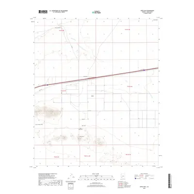
2018 Map of Aztec Hills
USGS Topo · Published 2018About this map
Aztec lies at the heart of this desert landscape, serving as a transit point in a region defined by the stark contrasts of the Yuma County terrain. The settlement sits along the modern transit corridor, but its roots are visible in the path of Old Hwy 80 and local streets like Cll Cananea. To the north, the ephemeral waters of Canyon Diablo and Tenmile Wash cut through the arid plains, while the southern horizon is dominated by the volcanic profiles of the Aztec Hills, White Mtn, and Half White Mtn. These peaks rise abruptly from the San Cristobal Valley, illustrating the classic basin-and-range topography. The map details a network of local roads such as Burm Blvd and Frontage Rd, which provide access to the vast open spaces of Park Valley and the surrounding desert floor.
Find a feature on this map
22 named features on this map. Tap any name to fly to it.
Don’t see what you’re looking for? This feature index may not catch every label — zoom into the map to look around manually.
Map Details
Editions of this 2018 Aztec Hills Map
This is the sole edition of this map. No revisions or reprints were ever made.
Other maps of this area

1927 · Aguila Mountains
USGS Topo · 1:48,000

1927 · Kim
USGS Topo · 1:62,500

1929 · Aztec
USGS Topo · 1:62,500

1930 · Aguila Mountains
USGS Topo · 1:62,500

1930 · Stoval
USGS Topo · 1:62,500

1931 · Kim
USGS Topo · 1:62,500

1950 · Stoval
USGS Topo · 1:62,500

1950 · Aztec
USGS Topo · 1:62,500

1953 · Ajo
USGS Topo · 1:250,000

1957 · Ajo
USGS Topo · 1:250,000