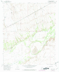
1965 Map of Aztec NW
USGS Topo · Published 1982About this map
Palomas (Site) stands as a focal point of historical interest along the northern bank of the Gila River in this arid Yuma County landscape. The map captures an era of desert ranching and early irrigation, documented by the presence of the White Wing Ranch and a network of water management features including the Farmers Canal, Gila Ditch, and South Gila Ditch. These human interventions contrast with the natural topography of Hyder Valley and Park Valley, where shifting Sand Dunes and the seasonal flows of Baragan Wash shape the terrain.
Find a feature on this map
29 named features on this map. Tap any name to fly to it.
Don’t see what you’re looking for? This feature index may not catch every label — zoom into the map to look around manually.
Map Details
Editions of this 1965 Aztec NW Map
3 editions found
Other maps of this area

1927 · Hyder
USGS Topo · 1:62,500

1929 · Aztec
USGS Topo · 1:62,500

1930 · Stoval
USGS Topo · 1:62,500

1930 · Hyder
USGS Topo · 1:62,500

1942 · Vicksburg
USGS Topo · 1:250,000

1950 · Stoval
USGS Topo · 1:62,500

1950 · Aztec
USGS Topo · 1:62,500

1953 · Ajo
USGS Topo · 1:250,000

1954 · Phoenix
USGS Topo · 1:250,000

1957 · Ajo
USGS Topo · 1:250,000