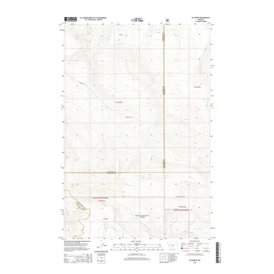
2014 Map of B K Ranch
USGS Topo · Published 2014About this map
BK Ranch serves as a lone namesake landmark in this high-elevation landscape where the boundaries of Cascade, Meagher, and Lewis and Clark counties meet. This 2014 survey captures a terrain defined by complex drainages, where the headwaters of Hound Cr, Crooked Cr, and Whitetail Cr carve through the foothills. The southern portion of the quadrangle transition into the protected lands of the Helena National Forest, a region anchored by the prominent Elk Ridge and the distinctively named Mil-mil-teh Hill. While modern infrastructure is sparse, restricted largely to routes like Cannon Lake Ln, the map provides an essential record of the natural waterways and original township and range lines—including t14n r1e and t13n r2e—that have organized this part of the Montana wilderness for over a century.
Find a feature on this map
21 named features on this map. Tap any name to fly to it.
Don’t see what you’re looking for? This feature index may not catch every label — zoom into the map to look around manually.
Map Details
Editions of this 2014 B K Ranch Map
This is the sole edition of this map. No revisions or reprints were ever made.
Other maps of this area

1886 · Great Falls
USGS Topo · 1:250,000

1886 · Fort Logan
USGS Topo · 1:250,000

1948 · White Sulphur Springs
USGS Topo · 1:250,000

1954 · Great Falls
USGS Topo · 1:250,000

1957 · Great Falls
USGS Topo · 1:250,000

1958 · White Sulphur Springs
USGS Topo · 1:250,000

1961 · White Sulphur Springs
USGS Topo · 1:250,000

1961 · Hound Creek Reservoir
USGS Topo · 1:24,000

1961 · Dana Ranch
USGS Topo · 1:24,000

1962 · Hogback Mountain
USGS Topo · 1:24,000