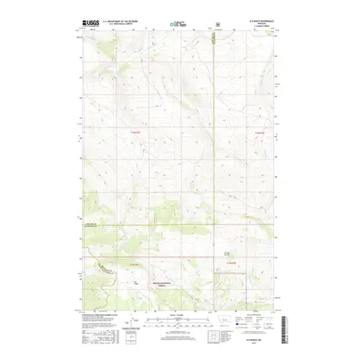
2017 Map of B K Ranch
USGS Topo · Published 2017About this map
Helena National Forest lands dominate the southern portion of this landscape, where the high ground of Elk Ridge and Mil-mil- teh Hill overlooks a complex network of mountain drainages. The area is defined by its water systems, primarily the northern-flowing Hound Creek and its tributary E Fork Hound Creek, which gather moisture from the timbered slopes. In the northern reaches, the B K Ranch represents the primary human footprint in a region otherwise characterized by natural boundaries and remote terrain. The map meticulously documents the intersection of three counties — Cascade, Meagher, and Lewis and Clark — illustrating how these political divisions follow the ridgelines and water divides. From the headwaters of Beaver Creek to the winding course of Crooked Creek, the survey provides a detailed view of the high-country hydrology and primitive access routes like pvt1 that serve the ranching and forest lands.
Find a feature on this map
21 named features on this map. Tap any name to fly to it.
Don’t see what you’re looking for? This feature index may not catch every label — zoom into the map to look around manually.
Map Details
Editions of this 2017 B K Ranch Map
This is the sole edition of this map. No revisions or reprints were ever made.
Other maps of this area

1886 · Great Falls
USGS Topo · 1:250,000

1886 · Fort Logan
USGS Topo · 1:250,000

1948 · White Sulphur Springs
USGS Topo · 1:250,000

1954 · Great Falls
USGS Topo · 1:250,000

1957 · Great Falls
USGS Topo · 1:250,000

1958 · White Sulphur Springs
USGS Topo · 1:250,000

1961 · White Sulphur Springs
USGS Topo · 1:250,000

1961 · Hound Creek Reservoir
USGS Topo · 1:24,000

1961 · Dana Ranch
USGS Topo · 1:24,000

1962 · Hogback Mountain
USGS Topo · 1:24,000